GEOGRAPHIC INFORMATION SYSTEMS (GIS)
GIS SERVICES
GIS plays a crucial role in the land development process by allowing us to visualize and understand the physical features on the earth’s surface. Analyzing this spatial data is an incredibly powerful tool that can lead to more informed and efficient decision making.
GIS at Greenway has a role in nearly all our practices—from site feasibility studies to post development analysis. It is a rapidly evolving science, and we strive to stay on top of the latest trends in the field.
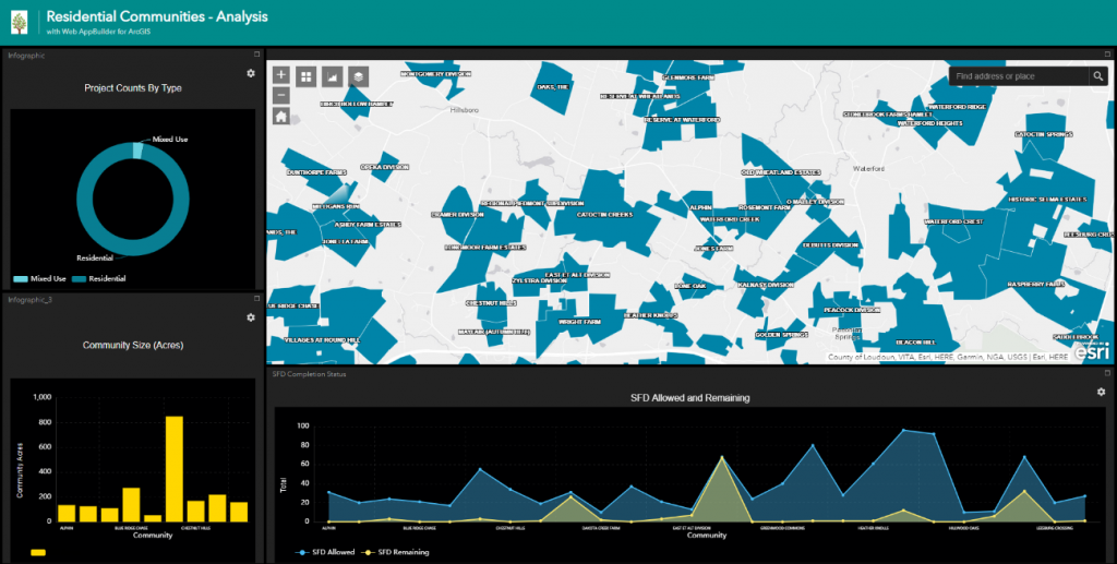
Dashboards Provide Real Time Analytics and Decision-Making Tools

Customized Mapping Accommodates Nearly Any Site Study or Analysis
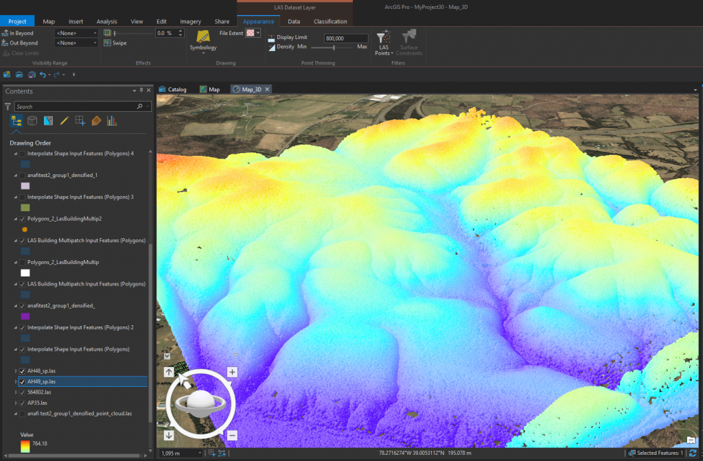
LiDAR Point Cloud Processing and Analysis
LIST OF GIS SERVICES
Customized Mapping and Spatial Data Analysis
LiDAR Point Cloud Derived Products
Mobile and Office GIS Applications Development and Consulting